When you thought "Mont Iseran" was over 4,000 metres high
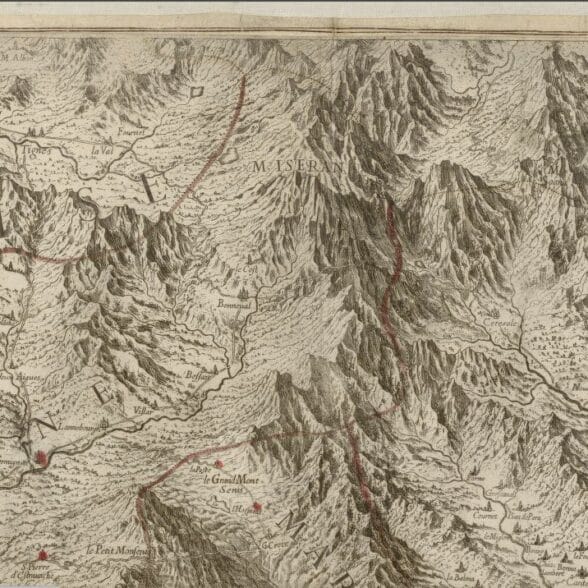
In the 17th century, cartographers referred to a mysterious "Mont Iseran", rising to 4045 metres above Bonneval sur Arc.
This "Mont Iseran" appears in 1680 on Borgonio's map as the source of the Isère and Arc rivers. The belief that there was a peak at over 4,000 metres in this area lasted for almost 200 years: over the years, one cartographer after another failed to pinpoint the exact location of this mythical peak, even though they asserted its existence. Mont Iseran", for example, is inscribed on staff maps from 1820 and 1866.
In 1859, precise surveys put an end to the myth: no peak in the area reached 4,000 metres. Mont Iseran" became "Signal du Mont Iseran", next to Aiguille Pers.
From mule track to Grandes Alpes road
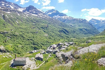
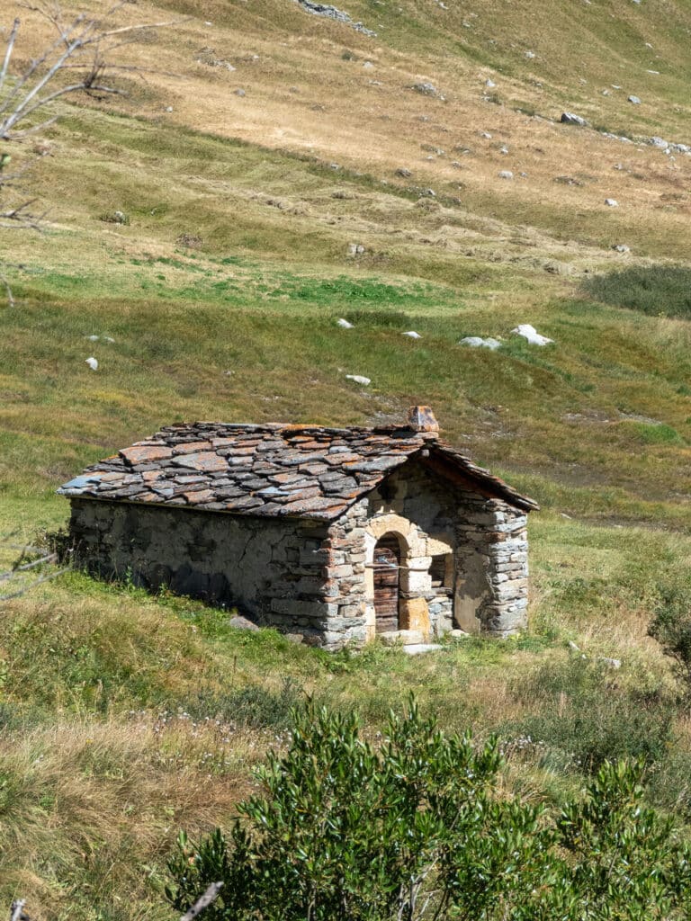
The pass has been a popular crossing point for centuries. In fact, it was important enough for the House of Savoy to order in 1667 that the Iseran crossings be kept in good condition, so that mules loaded with goods could cross the pass. Two centuries later, King Emmanuel II even had large stone cairns built along the trail. These cairns are of course used to mark the way, but some are hollow and offer shelter to travellers in stormy weather.
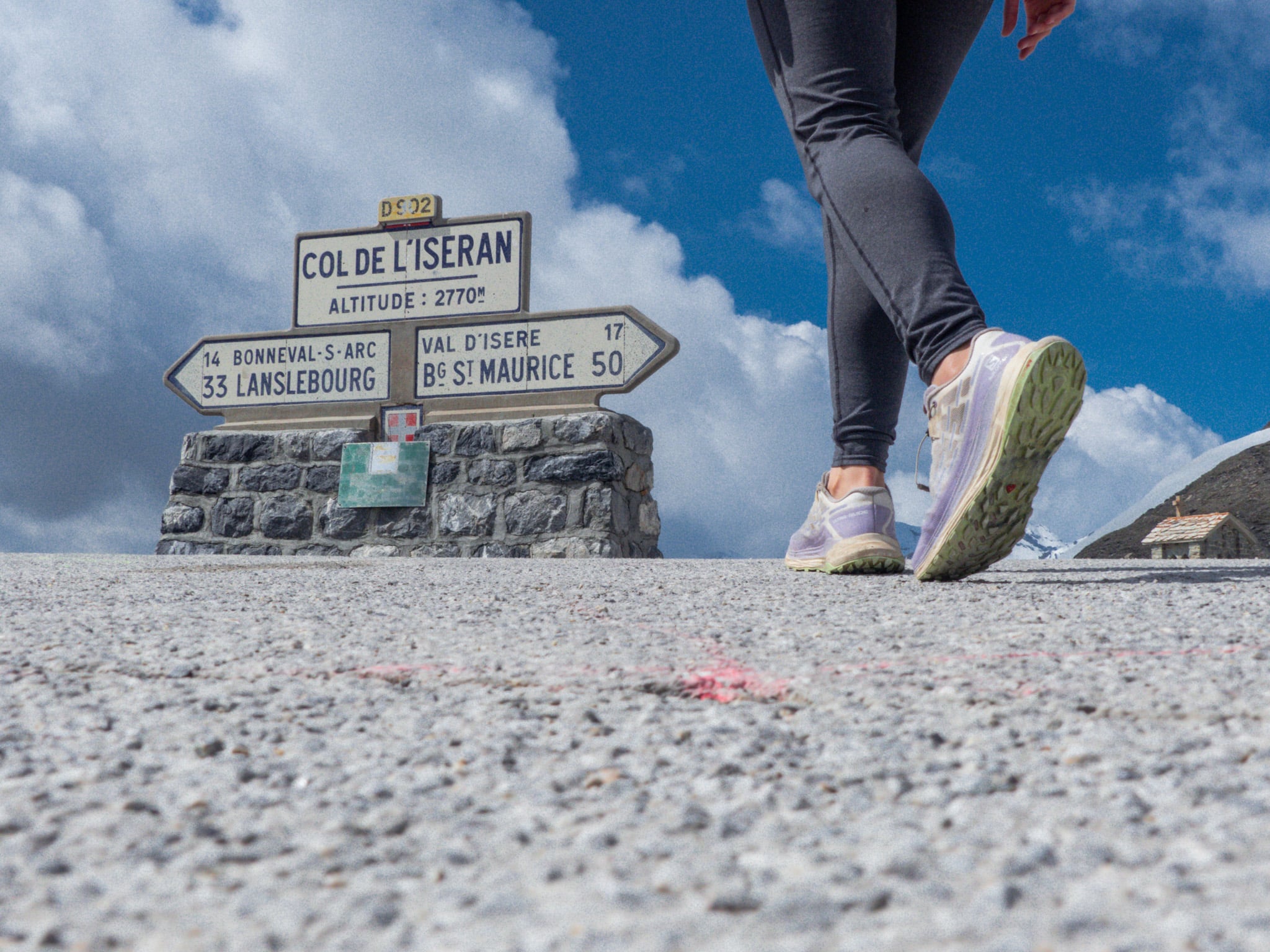
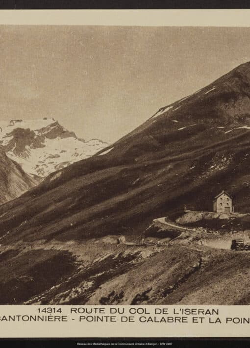
The history of the road that crosses the pass today is more recent. Built between 1929 and 1937 to open up the valleys and promote trade, it was inaugurated on July 10, 1937 by President Albert Lebrun. Since then, it has been Europe's highest road pass. The Col de l'Iseran is an essential part of the "Route des Grandes Alpes" linking Thonon-les-Bains (Haute-Savoie) to Nice (Alpes-Maritimes). Thousands of cyclists, motorcyclists and classic car enthusiasts follow this route every summer, enjoying the succession of passes and breathtaking panoramas.
Iseran joins the Tour de France
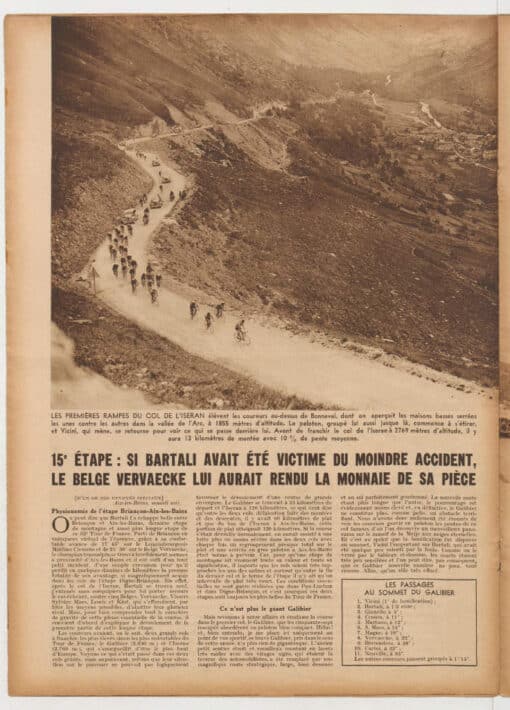
Rare but... Dantesque stages!Less than a year after its inauguration, the Col de l'Iseran road became part of Tour de France legend. On July 26, 1938, during the 15th stage from Briançon to Aix les Bains (a 311 km stage, the longest of the 32nd Tour de France!), the cyclists set off over the Iseran, whose road had not even been paved yet. Rain and snow were the order of the day, with a temperature of 0°C at the top of the pass. Belgian Félicien Vervaecke was the first to cross the Iseran, but it was Italian Gino Bartali who took the final victory in Paris. The following year, on July 29 1939, Bonneval sur Arc even became a stage town for the 33rd Tour de France.
Although the Tour passed through Iseran two years in a row at the end of the 1930s, the race's passage is rare but always spectacular. In 1996, the climb had to be neutralized due to weather conditions. And in 2019, the stage was halted just after crossing the pass, as hailstorms made the road impassable on the Tignes side.
A roadside heritage
Chapels and cantonal housesIt's not surprising to find chapels and shelters for travelers on such a busy route. The most spectacular is the chapel of Notre Dame de Toute Prudence at the summit of the Col de l'Iseran, built between 1937 and 1939, with its magnificent statue of the Virgin, carved from a single block measuring 4.15 m and weighing 5 tonnes, which watches over travellers and mountaineers on the Iseran.
As for the Chappelle Saint Barthélemy, easily seen on the roadside in the Lenta valley, its history is more mysterious. Was it built by a private individual in gratitude for a storm he had escaped? Or to ask for the Saint's protection near a tumultuous torrent? No one knows. The exact date of its construction also remains uncertain. However, its presence is attested as early as 1523. Restored several times, it is said that a traveller fell into the torrent while passing in front of it. He escaped, but lost a bag of gold coins on his back. Long afterwards, children were said to have found a worn gold coin on the Tralenta bridge near Bonneval sur Arc...
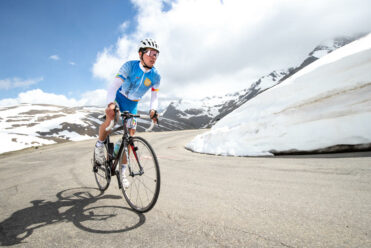
Cycling up the Col de l'Iseran
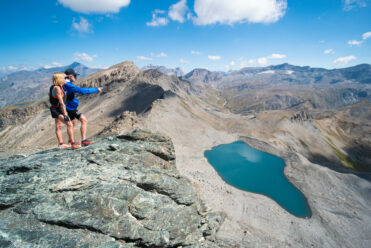
Breaking the 3,000 barrier on a hike