

5 gravel routes in Haute Maurienne Vanoise
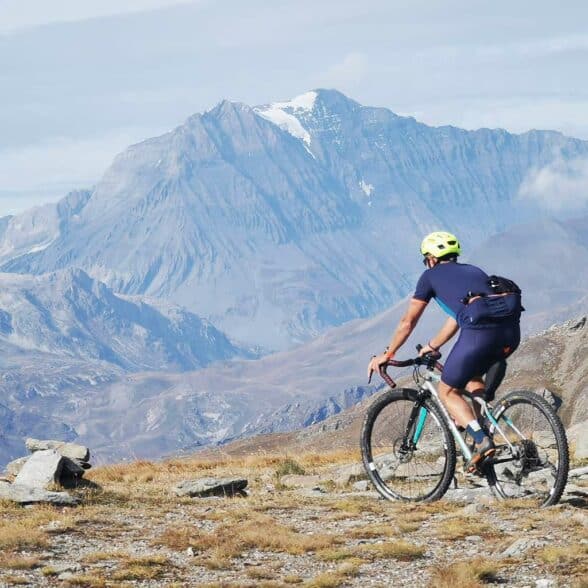
What is gravel?
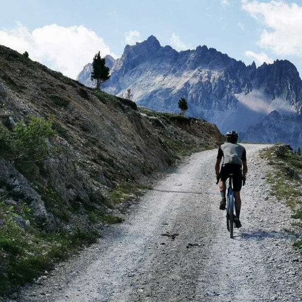
The bike's frame resembles that of a road bike, but the tires are wider and notched, with flared handlebars for easier steering and disc brakes for greater efficiency. A bike that recaptures the spirit of grandfather's bicycle, which made it possible to go everywhere at a time when not all roads were paved, but with 21st-century technologies.
"Some cyclists think that riding on trails or climbing mountains on tracks is very difficult, but what counts above all is desire," explains Jérôme Furbeyre, "you also need to know how to ride at speed, without getting burnt out on the climb. Gravel also allows you to pedal in a car-free environment, and offers enormous freedom: the freedom to take a path, a grass track, to take a trail... It's an adventure! On the other hand, you need to prepare your routes carefully to avoid getting stuck or having long portages. At Haute Maurienne Vanoise, we are fortunate to have a number of gravel-accessible itineraries, such as the superb " chemin du petit bonheur " at the bottom of the valley, or most of our cross-country mountain bike trails, which are classified as green, blue or red".
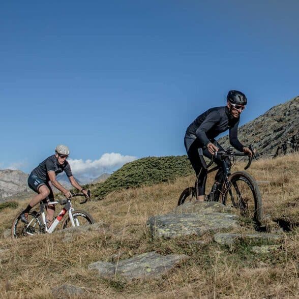
Gravel outings
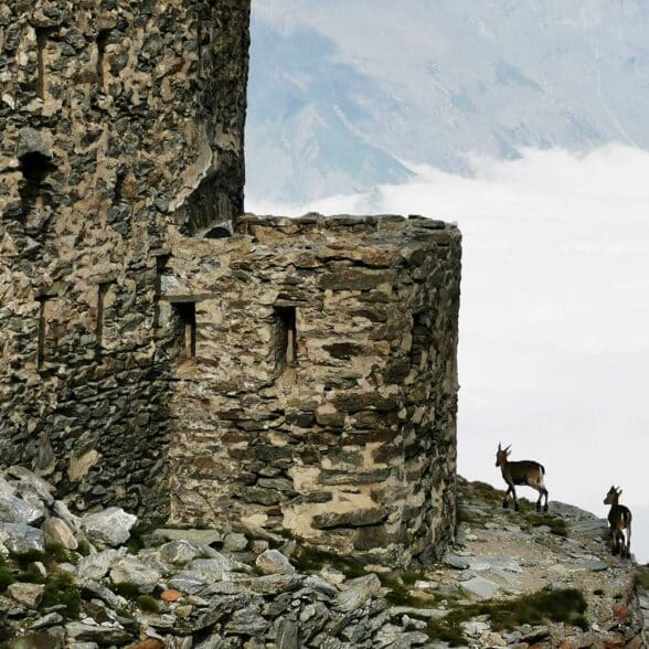
with Jérôme FurbeyreLe Malamot
A trail to an ancient fort at almost 3000 m altitude!Jérome Furbeyre: "The Fort de Malamot (2917m) is one of the highest fortifications at altitude. It was built by the Italians over a century ago. Perched on the ridge that leads to Pointe Droset, the fort boasts an exceptional, unobstructed view of the lake and the Col du Mont Cenis. Its strategic position and military activity were short-lived: disarmed in 1915, it was nevertheless the scene of some bloody battles, such as those in June 1940. Recaptured by the French in 1947, it now fights against time and lives on, solitary and silent. It's also a great place for a gravel outing.
You start from the left bank of the Mont Cenis dam, where the trail has been completely rebuilt for easy access to the dam. After crossing the dam, the long and unusual straight line gets you into the swing of things, before you start climbing up the old military track. One bend follows another and the climb becomes more and more physical, but it's pure alpine gravel. And what a reward at the finish! The view is extraordinary and the site incredible, with this ancient fort high above the clouds. We're in ibex country, which you can see quite often in this area.
Val Cenis. Departure from left bank of Mont Cenis dam, 2300 m. Arrival at Malamot fort, 2917 m. Return by the same route.
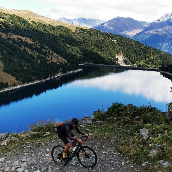
Col Clapier
In Hannibal's footstepsJérome Furbeyre: "If the classics are at the origin of traditional cycling, then all-road adventure trails in the mountains are a good description of what alpine gravel can be in the future. The Haute Maurienne valley has this unique feature: long, rolling, cross-border valleys and emblematic places that bear witness to historic episodes, which are perfect for gravel cycling. This route takes you back to the path of the Carthaginian general Hannibal, who is said to have passed through here over 2200 years ago with his army and elephants. The trail leads to Lac Savine (2443m) and then to Col Clapier (2477m).
A day's riding on a more than original route. We start at the Petit Mont Cenis refuge, then take the track leading to the Savine valley. There's a short portage just before Lac de Savine, but it's easy enough for all levels of fitness. It's also a very varied route, with a lovely grassy plain, the magnificent Lac de Savine, and then rocky terrain at the pass. Rather than descend immediately, you can also extend the adventure and spend the night at the Hannibal bivouac, a designer hut located just over the pass on the Italian side. This border area is quite frequented by French and Italian hikers, and rightly so: it's quite simply magical."
Val Cenis. Departure from Petit Mont Cenis refuge, 2120 m. Arrival Col Clapier 2477 m. Return by the same route.
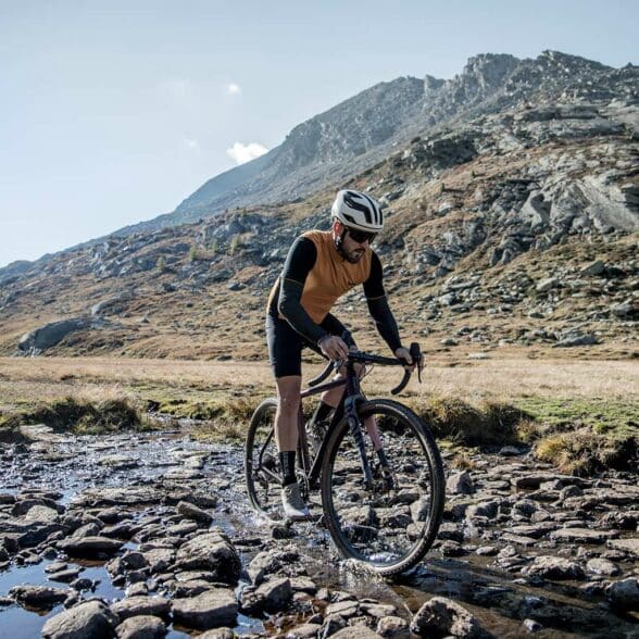
Fréjus Pass
A rolling and varied memory trailJérome Furbeyre: "This is a route I really like, on a memory trail. Above the Valfréjus resort, you start from Le Lavoir. You take the track that runs alongside the Le Lavoir cheese dairy (which allows you to stock up on Alpine Beaufort on the way back!), then on to the Pas du Roc. We skirt the former bunkers of the Maginot Line of the Alps, the scene of fierce fighting during the Second World War, notably in June 1940 when the Italians tried in vain to pass through on this side, before reaching the Col du Fréjus, on the Italian border.
A rolling, varied route. On arrival, there's a superb view of Italy and the great peaks and glaciers of the Vanoise, such as Polset and the Dent Parrachée. This area above Valfréjus offers many other possibilities for gravel outings, including the Col de la Roue, the Vallée étroite and the Refuge du Thabor. These are very high-mountain itineraries, but they are more technical and physical than the more accessible Col du Fréjus.
Valfréjus. Start from Lavoir parking lot, 1905m. Arrival Col du Fréjus 2538m. Return by the same route.
Le fond d'Aussois
Gravel in the heart of the Vanoise National ParkJérôme Furbeyre: "A classic itinerary is quite busy at the height of summer. This is understandable: the setting is simply magnificent and the ride is fairly easy. Personally, I really like this gravel outing because it's a fun and varied way to get out and about in the heart of the Vanoise National Park, with a nice reward on arrival at the refuge: superb views, home-made pie and beer brewed by the refuge keeper!
Departure is from the Aussois dam parking lot. The trail skirts the Plan d'Amont lake, then climbs to the Sétéria bridge. Don't follow the path along the stream, but stay on the classic hiking trail, even if there is a slightly more technical section with rocks. You may have to make a short portage, but you'll soon reach the valley that leads quietly to the refuge. We're in the heart of the Vanoise National Park, with lots of marmots and... hikers! As always, you have to be careful to ensure that cyclists and hikers get on well together.
Aussois. Departure parking de la carrière (Aussois dams) 2000 m. Arrival at the Fond d'Aussois refuge 2346 m. Return by the same route.
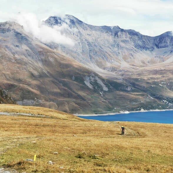
Col de Sollières
Grand tour gravel and 1400 m ascentJérôme Furbeyre: "A superb tour from Val Cenis-Termignon. We climb up the piste to the Replat des canons and then reach the Col de Sollières, at an altitude of 2,760 m, with a vertical drop of almost 1,400 m! But don't worry, it's a good climb on a very good trail. The first part is in the forest, then you join the old military track up to the pass. It's a very varied route that offers superb panoramic views of the entire Mont Cenis plateau on arrival. It's also a place of remembrance, as here too, fierce fighting took place during the Second World War, particularly in the final months, with German soldiers entrenched on Mont Froid and the French trying to dislodge them.
Once you've reached the pass, you can set off again by the same route, but I recommend descending to the Petit Mont Cenis refuge for a well-deserved break. Those who still have some energy left can then continue on to the Pattacreuse fort or head straight back down via the Col du Mont Cenis and Val Cenis-Lanslebourg. A great gravel adventure!
Val Cenis. Departure from Val Cenis-Termignon, 1300 m. Arrival Col de Sollières 2760 m. Return by the same route or via the Col du Mont Cenis.

Bicycle-friendly accommodation
Your bike deserves the best accommodation, too!Because your bike deserves as much a place in your vacation rental as it does in your heart, our team has selected the most bike-friendly apartments and chalets on Haute Maurienne Vanoise : with at least one secure storage area for your precious two wheels!
Discover our selection of "Vélo-Friendly" furnished accommodation