Breaking the "3000" barrier on a hike
Top 5 hikes
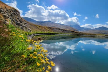
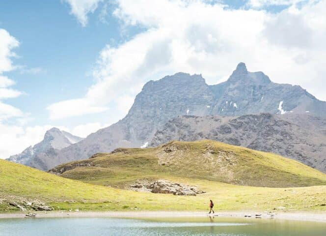
à 3000Le Rateau
3 131 mStart/finish point: Parking du Plan d'Amont, Aussois
Difference in altitude: +1100 m/- 1100m
Distance: 11.5 km
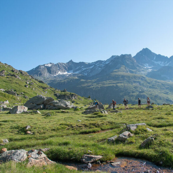
The Rateau summit offers a 3000-meter peak that's easy enough to climb in high summer. The majority of the route takes you along a well-marked high-level path.
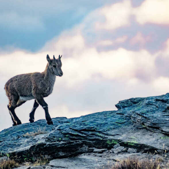
From the parking lot at the Plan d'Amont dam, head for the Pont de la Sétéria (2,206 m), then follow the GR5 as it climbs steeply to a landing (the beautiful "Plateau du Mauvais Berger", with its carpet of grass dotted with erratic boulders, a marmot's playground). The trail then twists and turns towards the Col de la Masse (2,923 m). Here, you may be lucky enough to come across the female ibex, who often spend the summer in this area with their young (the éterlous).
At the Col de la Masse, continue south to the summit. On this final ascent, the path is unmarked, but numerous cairns guide you to the summit, where you'll find a veritable forest of cairns and a panoramic view all the way to Mont Blanc.
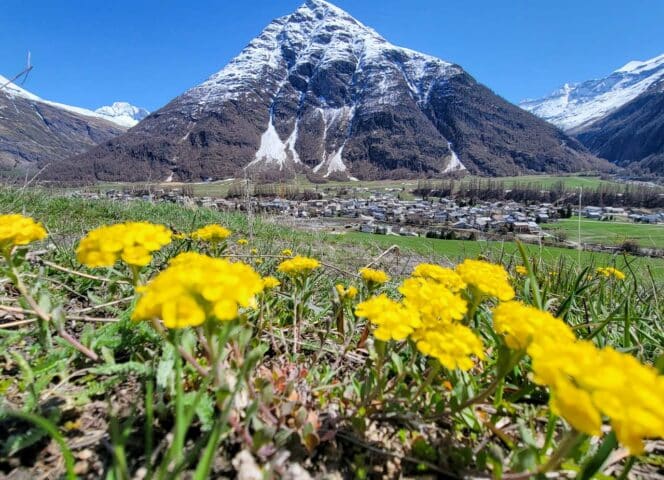
Mount Tabor
3 178 mStart/finish point: parking du Lavoir, Valfréjus
Difference in altitude: +1255 m/- 1255 m
Distance: 20 km
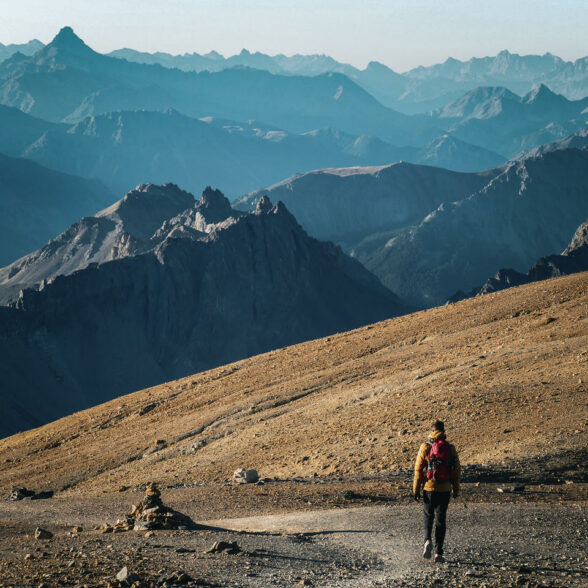
Departing from the Valfréjus resort or directly from the Lavoir parking lot, the Thabor massif is a hiker's paradise. A wild itinerary winding between lakes and scree slopes leads to a superb summit where the mineral landscape becomes lunar, and the panorama exceptional on prestigious summits: Grandes Jorasses, Cervin, Grande Casse, Mont Viso... The Natura 2000 site of Mont Thabor invites you to come and breathe deeply the invigorating air of its natural zone where fauna and flora combine wonderfully.
A very accessible 3000 m: Mont Thabor remains mysterious and arouses curiosity with its authentic, wild character. What's more, its remarkable geological history makes it a mine of natural treasures. You'll also come across several high-altitude lakes offering refreshing breaks. When you finally reach the summit, you'll be amazed by the mineral, almost Martian atmosphere of Le Thabor. Another planet, just a few hours' walk from the Valfréjus resort and Modane train station... You'll also enjoy an incredible 360° view of Italy, the Southern Alps, Mont Blanc...
Please note: although the hike is not particularly difficult for seasoned walkers (some Lyon-based runners even took up the challenge of a 3000 in one day, leaving Lyon early in the morning, taking the freeway to Modane, parking at Le Lavoir, climbing to Le Thabor and returning to Lyon in the evening!), it is still quite long. The easiest way to complete this two-day hike is to spend the night at the Le Thabor refuge.
“Mountain Hiking: 6 Days for Those Who Want to Go High” Trip
Starting at €737.00*
Emerald waters, endless ridges, and the silence of the great outdoors: experience six days of exploration in the heart of an unspoiled mountain range.
* The all-inclusive week.
Observatory Point
3 016 mStart/finish: parking du Plan d'Amont, Aussois
Difference in altitude: +1000 m/-1000 m
Distance: 11 km
A hike with no technical difficulties taking you to the Pointe de l'Observatoire via the Col d'Aussois (2,916m). A "real summit", well pointed at the top, a pretty "observatory" overlooking the Aussois valleys, the great Vanoise peaks and Mont-Blanc. It marks the transition between the Tarentaise and Maurienne valleys.
Apart from the off-trail section to reach the Pointe from the Col d'Aussois, the route is well-marked and non-technical. The route starts from the dam at Lac de Plan d'Amont and continues on the peaceful Fond d'Aussois plateau, in the heart of the unspoilt environment of the Vanoise National Park, an ideal place to discover the fauna (especially marmots) and flora.
The Fond d'Aussois hut, at the end of the valley, awaits you for a gourmet break before climbing to the pass and summit.

Le Signal du Petit Mont-Cenis
3 162 mStart/finish point: Parking du refuge du Petit Mont-Cenis, Val Cenis
Difference in altitude: +1040 m/-1040 m
Distance: 12 km
A beautiful "3000" between France and Italy. From the Petit Mont-Cenis refuge parking lot, head for the Col de Sollières (2,639 m) and follow the footpath to the summit ridge.
A commemorative plaque on the Signal du Petit Mont-Cenis pays tribute to this historic summit. Alpine hunter units fought bloody battles here in April 1945. A peace trail winds through lush meadows and bizarrely eroded terrain.
At the summit, admire the wide Col du Mont-Cenis and its large lake. To the south, you can discover the peaks of the Dents d'Ambin. To the north, the Vanoise glaciers and the Dent Parrachée dominate the panorama.
La Pointe des Fours
3 072 mStart/finish point: Pont de la Neige, route de l'Iseran, Bonneval sur Arc.
Difference in altitude: +550 m/-550 m
Distance: 6 km
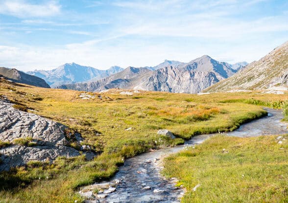
A 3000 without too much ascent? The Pointe des Fours! It starts at almost 2,700 m, at the Pont de la Neige, just below the Col de l'Iseran. From the parking lot, the trail is perfectly marked. It climbs rapidly at first, then more gently to the Lac du Grand Fond. The Col des Fours is just above, and all that remains is to follow the ridge to the Pointe. Be careful on this last section, which is quite airy.
At the entrance to the Vanoise National Park, the Pointe des Fours invites you to take a short, beautiful hike in a high-mountain mineral world. It's not unusual to come across chamois and marmots.
An ultra-fast 3000, ideal for a limited time window. Beware, however, as there will still be plenty of snow until mid-July, and you'll need special equipment to negotiate it. What's more, the final passage between the Col des Fours and the Pointe requires you to put your hands down.
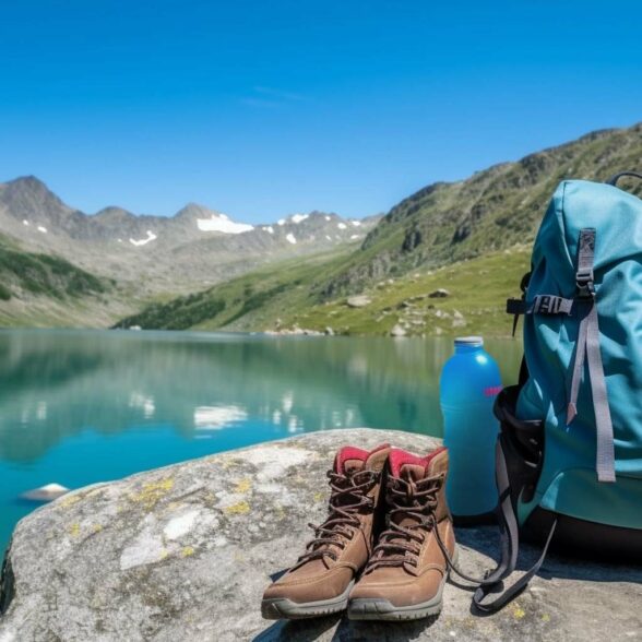
Mountain safety
These tours require a minimum of equipment:
- Hiking shoes
- Change of socks and T-shirt + warm clothes in backpack (even in heatwaves, temperatures at 3000m can be very cool)
- Food and at least two liters of water per person
- Sunscreen, cap, IGN map, GPS and charged phone
These high-altitude peaks are accessible by "classic" hikers in July/August/September (residual snow may still be present in early July). Remember to tell someone about your itinerary and let them know when you're back. Finally, for these high-altitude hikes, leave early: you'll avoid finishing the hike at dusk, and you'll limit the risk of thunderstorms at the end of the day (always possible in the mountains in very hot weather).
For 100% safety, don't hesitate to call on the services of a mountain leader: professionals know how to guide you in your technical progress.
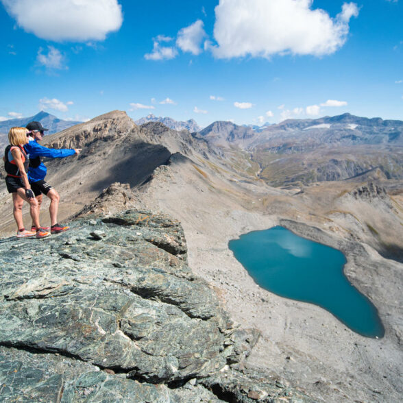
Get close to the 3,000 mark and take in the sights!
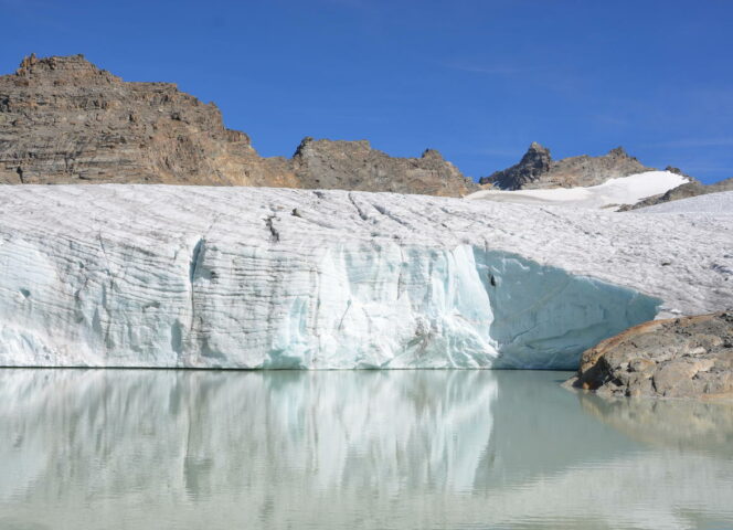
Three peaks that don't reach 3,000 metres, but which offer incredible hiking opportunities. The Grand Méan glacier, with its ice cliff plunging into the lake, is simply a must-see in the Alps.Le Grand Méan
2876 mA grandiose hike to the glacial lake of Grand Méan, offering a spectacle worthy of the greatest expeditions. Starting from the hamlet of l'Ecot (2,000 m) above Bonneval sur Arc, a path climbs steadily up to the splendid Cirque des Evettes and the eponymous refuge. Built by architect Jean Prouvé in the 1970s, this atypically designed building offers hikers a gourmet break close to marmots and ibex. One last effort and the Lac du Grand Méan appears at an altitude of 2,876 m, revealing a landscape at the end of the world. The glacier ends abruptly in an impressive ice cliff that plunges straight down into the crystal-clear waters where icebergs float... Surrounded by peaks over 3000m high, it's an unforgettable sight! And if you're lucky, you might even spot a herd of ibex that often spends the summer in this area.
The Point and Lakes of Lanserlia
2909 mA less-frequented route than the classic Col de Lanserlia climbs. The off-trail section is not very difficult and the route forms a complete loop. Antecime 2886 dominates the Plan du Lac and Rochers de Lanserlia in spectacular fashion, a veritable explosion of ruiniform towers and bell towers in a detrital setting. The three Lanserlia lakes, with their curiously different colors, are nestled in a cirque covered in beautiful alpine grass, with the imposing Grand Roc Noir (3,582 m) and Pointe du Vallonet (3,372 m) in the background. A wild hike in the heart of the Vanoise National Park 's unspoilt environment, from the Bellecombe parking lot above Val Cenis-Termignon.
La Pointe de Tierce
2973 mLocated at the entrance to the Avérole and Ribon valleys, the Pointe de Tierce offers an exceptional 360° panorama. The view over the Avérole valley is breathtaking: the Pointe de Charbonnel (3,752 m), the Bessanèse (3,592 m), the Albaron (3,637 m), the Pointes de l'Ouillarse (3,435 m), the Ouille Allegra (3,130 m). A mythical summit with its chapel and cross! Every year, on July 16, a pilgrimage takes place to the chapel of Notre-Dame du Mont-Carmel: writings trace the origins of this high-mountain chapel back to 1446, making it one of the oldest in Europe.
The cross 50 meters below the chapel overlooking the village of Bessans was erected to protect it from avalanches in winter. To reach the Pointe from Bessans, take the track leading to the Ribon valley and fork left at the Sainte-Anne oratory-shelter. The trail first passes through a larch forest, then through a sheep pasture. Be careful, the whole path is narrow and steep. But the effort pays off: an unforgettable hike with views of all the major peaks in the area.
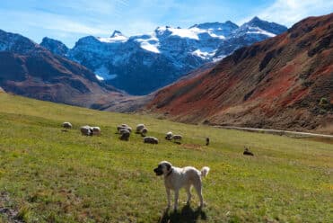
Meeting a Patou: what are the right things to do?
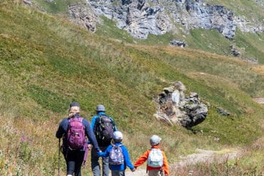
Hiking in the heart of the Alps